
New York
From jeena
| State of New York | |||||
| |||||
| Nickname(s): The Empire State | |||||
| Motto(s): Excelsior (Latin)[1] Ever upward | |||||
 | |||||
| Official language(s) | None | ||||
| Spoken language(s) | English (only) 71.8% Spanish 14.0% Others 14.1%[2] | ||||
| Demonym | New Yorker | ||||
| Capital | Albany | ||||
| Largest city | New York City | ||||
| Largest metro area | New York City Metropolitan Area | ||||
| Area | Ranked 27th in the U.S. | ||||
| - Total | 54,556[3] sq mi (141,300 km2) | ||||
| - Width | 285 miles (455 km) | ||||
| - Length | 330 miles (530 km) | ||||
| - % water | 13.5 | ||||
| - Latitude | 40° 30′ N to 45° 1′ N | ||||
| - Longitude | 71° 51′ W to 79° 46′ W | ||||
| Population | Ranked 3rd in the U.S. | ||||
| - Total | 19,465,197 (2011 est)[4] | ||||
| - Density | 412/sq mi (159/km2) Ranked 7th in the U.S. | ||||
| Elevation | |||||
| - Highest point | Mount Marcy[5][6][7] 5,344 ft (1628.85 m) | ||||
| - Mean | 1,000 ft (304.8 m) | ||||
| - Lowest point | Atlantic Ocean[6][7] sea level | ||||
| Admission to Union | July 26, 1788 (11th) | ||||
| Governor | Andrew Cuomo (D) | ||||
| Lieutenant Governor | Robert Duffy (D) | ||||
| Legislature | New York Legislature | ||||
| - Upper house | State Senate | ||||
| - Lower house | State Assembly | ||||
| U.S. Senators | Charles Schumer (D) Kirsten Gillibrand (D) | ||||
| U.S. House delegation | 21 Democrats, 8 Republicans (list) | ||||
| Time zone | Eastern: UTC -5/-4 | ||||
| Abbreviations | NY US-NY | ||||
| Website | www.ny.gov | ||||

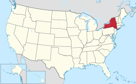
New York ( i/nuː ˈjɔrk/; locally IPA: [nɪu ˈjɔək]) is a state in the Northeastern region of the United States. New York is the 27th most extensive, the 3rd most populous, and the7th most densely populated of the 50 United States. New York is bordered by New Jersey and Pennsylvania to the south, and by Connecticut, Massachusetts and Vermontto the east. The state has a maritime border with Rhode Island east of Long Island, as well as an international border with the Canadian provinces of Ontario to the west and north, and Quebec to the north. The state of New York is often referred to as New York State to distinguish it from New York City.
New York City, with a population of over 8.1 million, is the most populous city in the United States. Alone, it makes up over 40 percent of the population of New York state. It is known for its status as a center for finance and culture and for its status as the largestgateway for immigration to the United States. According to the U.S. Department of Commerce, New York City is also a destination of choice for many foreign visitors. Both the state and city were named for the 17th century Duke of York, James Stuart, futureJames II and VII of England and Scotland.
New York was inhabited by various tribes of Algonquian and Iroquoian speaking Native American tribes at the time Dutch settlers moved into the region in the early 17th century. In 1609, the region was first claimed by Henry Hudson for the Dutch. Fort Nassau was built near the site of the present-day capital of Albany in 1614. The Dutch soon also settled New Amsterdam and parts of the Hudson River Valley, establishing the colony of New Netherland. The British took over the colony by annexation in 1664.
The borders of the British colony, the Province of New York, were roughly similar to those of the present-day state. About one third of all the battles of the Revolutionary War took place in New York. The state constitution was enacted in 1777. New York became the 11th state to ratify the United States Constitution, on July 26, 1788.
Contents[hide]
|
History
Main article: History of New York
17th century
See also: Province of New York
Henry Hudson's 1609 voyage marked the beginning of the European involvement with that area. Sailing for the Dutch East India Company and looking for a passage to Asia, he entered the Upper New York Bay on September 11 of that year. After his return word of his findings quickly spread and Dutch merchants began to explore the coast in search for profitable fur trade. During the 17th century, Dutch trading posts established for the trade of pelts from the Lenape, Iroquois and other indigenous peoples expanded into the colony of New Netherland. The first of these trading posts were Fort Nassau (1614, near present-day Albany); Fort Orange (1624, on the Hudson Riverjust south of the current city of Albany and created to replace Fort Nassau), developing into settlement Beverwijck (1647), and into what became Albany; Fort Amsterdam (1625, to develop into the town New Amsterdam which is present-day New York City); and Esopus, (1653, now Kingston). The success of the patroonship of Rensselaerswyck (1630), which surrounded Albany and lasted until the mid 19th century, was also a key factor in the early success of the colony. The English captured the colony during the Second Anglo-Dutch Warand governed it as the Province of New York. The city of New York was recaptured by the Dutch once again in 1673 during the Third Anglo-Dutch War (1672–1674) and renamed New Orange, but returned to the English under the terms of the Treaty of Westminster a year later.[8]
American Revolution

The Sons of Liberty were organized in New York City during the 1760s, largely in response to the oppressive Stamp Act passed by the British Parliament in 1765. The Stamp Act Congressmet in the city on October 19 of that year: a gathering of representatives from across theThirteen Colonies that set the stage for the Continental Congress to follow. The Stamp Act Congress resulted in the Declaration of Rights and Grievances, which was the first written expression by representatives of the Americans of many of the rights and complaints later expressed in the United States Declaration of Independence, including the right torepresentative government.
The Capture of Fort Ticonderoga provided the cannon and gunpowder necessary to force aBritish withdrawal from the Siege of Boston in 1775.
New York endorsed the Declaration of Independence on July 9, 1776.[9] The New York state constitution was framed by a convention which assembled at White Plains, New York on July 10, 1776, and after repeated adjournments and changes of location, terminated its labors atKingston, New York on Sunday evening, April 20, 1777, when the new constitution drafted byJohn Jay was adopted with but one dissenting vote. It was not submitted to the people for ratification. On July 30, 1777, George Clinton was inaugurated as the first Governor of New Yorkat Kingston.
The first major battle of the American Revolutionary War after independence was declared—and the largest battle of the entire war—was fought in New York at the Battle of Long Island (a.k.a. Battle of Brooklyn) in August 1776. British victory made New York City their military and political base of operations in North America for the duration of the conflict, and consequently the center of attention for GeneralGeorge Washington's intelligence network.

The notorious British prison ships of Wallabout Bay saw more American combatants die of intentional neglect than were killed in combat in every battle of the war, combined.
The first of two major British armies were captured by the Continental Army at the Battle of Saratoga in 1777, influencing France to ally with the revolutionaries.
In an attempt to retain their sovereignty and remain an independent nation positioned between the new United States and British North America, four of the Iroquois nations fought on the side of the British; only the Oneidas and their dependents the Tuscaroras allied themselves to the Americans.[10] The Sullivan Expedition of 1778 and 1779 destroyed nearly 50 Iroquois villages and adjacent croplands, forcing many refugees to British-held Niagara.[11] As allies of the British, the Iroquois were resettled in Canada after the war. In the treaty settlement, the British ceded most Indian lands to the new United States. Because New York made treaty with the Iroquois without getting Congressional approval, some of the land purchases are the subject of modern-day claims by the individual tribes. More than 5 million acres (20,000 km2) of former Iroquois territory was put up for sale in the years after the Revolutionary War, leading to rapid development in upstate New York.[12] As per the Treaty of Paris, the last vestige of British authority in the former Thirteen Colonies—their troops in New York City—departed in 1783, which was long afterwards celebrated as Evacuation Day.[13]
Following heated debate, which included the publication of the now quintessential constitutional interpretation—the Federalist Papers—as a series of installments in New York City newspapers, New York was the 11th state to ratify the United States Constitution, on July 26, 1788.[14]
19th century

Transportation in western New York was difficult before canals were built in the early part of the 19th century. The Hudson and Mohawk Rivers could be navigated only as far as Central New York. While the St. Lawrence River could be navigated to Lake Ontario, the way westward to the other Great Lakes was blocked by Niagara Falls, and so the only route to western New York was over land.
Governor DeWitt Clinton strongly advocated building a canal to connect the Hudson River withLake Erie, and thus all of the Great Lakes. Work commenced in 1817, and the Erie Canal was finished in 1825. It was considered an engineering marvel. Packet boats traveled up and down the canal with sightseers and visitors on board.[15] The canal opened up vast areas of New York to commerce and settlement. It enabled Great Lakes port cities such as Buffalo and Rochesterto grow and prosper. It also connected the burgeoning agricultural production of the Midwest and shipping on the Great Lakes, with the port of New York City. Improving transportation, it enabled additional population migration to territories west of New York.
During the American Civil War, New York provided more than 370,000 soldiers to the Union armies. Over 53,000 New Yorkers died in service, roughly 1 of every 7 who served.[16]
Ellis Island
Main article: Ellis Island


Ellis Island was the main facility for immigrants, entering the United States in the late 19th century to the mid 20th century. It was opened when the federal government took over the responsibility for processing immigrants, prior to that it was the responsibility of the states. It replaced the prior New York State immigration center located at Castle Clinton, a War of 1812 era fort located in what is today Battery Park, through which at least 8 million immigrants such as Harry Houdini, passed through from 1855–1890.[17]
Ellis Island operated as an immigration center from January 1, 1892, until November 12, 1954. It is owned by the Federal government and is now part of the Statue of Liberty National Monument, under the jurisdiction of the National Park Service. It is situated in New York Harbor, between two states and cities, Jersey City, New Jersey and New York, New York.
More than 12 million immigrants passed through Ellis Island, between 1892 and 1954. After 1924, when the National Origins Act was passed, the only immigrants to pass through there were displaced persons or war refugees.[18] Today, over 100 million Americans can trace their ancestry to the immigrants, who first arrived in America through Castle Clinton and Ellis Island, before dispersing to points all over the country. Ellis Island was the subject of a border dispute between New York State and New Jersey. The issue was settled in 1998 by the U.S. Supreme Court which ruled that the original 3.3 acre island was New York State territory and that the balance of the 27.5 acres (11 ha) added after 1834 by landfill was in New Jersey.
Statue of Liberty
Main article: Statue of Liberty

The Statue of Liberty, designed by Frédéric Bartholdi, was a gift from France to the United States to mark the Centennial of the American Declaration of Independence. The idea of giving a colossal representation of republican virtues to a "sister" republic, across the sea, served as a focus for the republican cause against other politicians. The Statue of Liberty was dedicated in New York Harbor on October 28, 1886.
Liberty Island closed on September 11, 2001; the island reopened in December, the monument reopened on August 3, 2004, but the statue remained closed until the summer of 2009. The National Park Service claims that the statue is not shut because of a terrorist threat, but principally because of a long list of fire regulation contraventions, including inadequate evacuation procedures. The museum and ten-story pedestal are open for visitors, but are only accessible if visitors have a "Monument Access Pass", which is a reservation that visitors must make in advance of their visit and pick up before boarding the ferry. There are a maximum of 3000 passes available each day, with a total of 15,000 visitors to the island daily. The interior of the statue remains closed, although a glass ceiling in the pedestal allows for views of Gustave Eiffel's iron framework of Lady Liberty.
Geography
Main article: Geography of New York


New York covers 54,556 square miles (141,300 km2) and ranks as the 27th largest state by size.[3] The Great Appalachian Valley dominates eastern New York, while Lake Champlain is the chief northern feature of the valley, which also includes the Hudson River flowing southward to the Atlantic Ocean. The rugged Adirondack Mountains, with vast tracts of wilderness, lie west of the valley.
Most of the southern part of the state is on the Allegheny Plateau, which rises from the southeast to the Catskill Mountains. The western section of the state is drained by the Allegheny River and rivers of the Susquehanna and Delaware systems. The Delaware River Basin Compact, signed in 1961 by New York, New Jersey, Pennsylvania, Delaware, and the federal government, regulates the utilization of water of the Delaware system. The highest elevation in New York is Mount Marcyin the Adirondacks.[19]
New York's borders touch (clockwise from the west) two Great Lakes (Erie and Ontario, which are connected by the Niagara River); the provinces of Ontario and Quebec in Canada; Lake Champlain; three New England states (Vermont, Massachusetts, and Connecticut); the Atlantic Ocean, and two Mid-Atlantic States, New Jersey and Pennsylvania. In addition, Rhode Island shares a water border with New York. New York is the only state that touches both the Great Lakes and the Atlantic Ocean, and is the second-largest of the original Thirteen Colonies.
In contrast with New York City's urban atmosphere, the vast majority of the state is dominated by farms, forests, rivers, mountains, and lakes. New York's Adirondack Park is the largest state park in the United States. It is larger than the Yellowstone, Yosemite, Grand Canyon, Glacier and Olympic National Parks combined.[20] New York established the first state park in the United States at Niagara Falls in 1885. Niagara Falls, on the Niagara River as it flows from Lake Erie to Lake Ontario, is a popular attraction.
The Hudson River begins at Lake Tear of the Clouds and flows south through the eastern part of the state without draining Lakes George orChamplain. Lake George empties at its north end into Lake Champlain, whose northern end extends into Canada, where it drains into theRichelieu and then the St. Lawrence Rivers. Four of New York City's five boroughs are on three islands at the mouth of the Hudson River:Manhattan Island; Staten Island; and Long Island, which contains Brooklyn and Queens on its western end.
Upstate and downstate are often used informally to distinguish New York City or its greater metropolitan area from the rest of New York State. The placement of a boundary between the two is a matter of great contention.[21] Unofficial and loosely defined regions of Upstate New York include the Southern Tier, which often includes the counties along the border with Pennsylvania,[22] and the North Country, which can mean anything from the strip along the Canadian border to everything north of the Mohawk River.[23]
Climate
Main article: Climate of New York

In general, New York has a humid continental climate, though under the Köppen climate classification, New York City has a humid subtropical climate.[24] Weather in New York is heavily influenced by two continental air masses: a warm, humid one from the southwest and a cold, dry one from the northwest.
The winters are long and cold in the Plateau Divisions of the state. In the majority of winter seasons, a temperature of −13 °F (−25 °C) or lower can be expected in the northern highlands (Northern Plateau) and 5 °F (−15 °C) or colder in the southwestern and east-central highlands (Southern Plateau). The summer climate is cool in the Adirondacks, Catskills and higher elevations of the Southern Plateau.
The New York City/Long Island area and lower portions of the Hudson Valley have rather warm summers by comparison, with some periods of high, uncomfortable humidity. The remainder of New York State enjoys pleasantly warm summers, marred by only occasional, brief intervals of sultry conditions. Summer daytime temperatures usually range from the upper 70s to mid 80s °F (25 to 30 °C), over much of the state.
New York ranks 46th among the 50 states in the amount of greenhouse gases generated per person. This relative efficiency is primarily due to the state's higher rate of mass transit use.[25]
Monthly Normal High and Low Temperatures For Various New York Cities[26] (Fahrenheit) City Jan Feb Mar Apr May Jun Jul Aug Sep Oct Nov Dec Albany max
min31
1334
1644
2557
3670
4678
5582
6080
5871
5060
3948
3136
20Binghamton max
min28
1531
1741
2553
3566
4673
5478
5976
5768
5057
4044
3133
21Buffalo max
min31
1833
1942
2654
3666
4875
5780
6278
6070
5359
4347
3436
24Lake Placid max
min27
532
840
1654
2966
3974
4878
5376
5169
4456
3444
2532
12Long Beach max
min39
2340
2448
3158
4069
4977
6083
6682
6475
5764
4554
3644
28New York City max
min38
2641
2850
3561
4471
5479
6384
6982
6875
6064
5053
4143
32Rochester max
min31
1733
1743
2555
3568
4677
5581
6079
5971
5160
4147
3336
23Syracuse max
min31
1434
1643
2456
3568
4677
5582
6080
5971
5160
4047
3236
21
Monthly Normal High and Low Temperatures For Various New York Cities (Celsius) City Jan Feb Mar Apr May Jun Jul Aug Sep Oct Nov Dec Albany max
min−1
−111
−97
−414
221
826
1328
1627
1422
1016
49
−12
−7Binghamton max
min−2
−9−1
−85
−412
219
823
1226
1524
1420
1014
47
−11
−6Buffalo max
min−1
−81
−76
−312
219
924
1427
1726
1621
1215
68
12
−4Lake Placid max
min−3
−150
−134
−912
−219
423
926
1224
1121
713
17
−40
−11Long Beach max
min4
−54
−49
−114
421
925
1628
1928
1824
1418
712
27
−2New York City max
min3
−35
−210
216
722
1226
1729
2128
2024
1618
1012
56
0Rochester max
min−1
−81
−86
−413
220
825
1327
1626
1522
1116
58
12
−5Syracuse max
min−1
−101
−96
−413
220
825
1328
1627
1522
1116
48
02
−6Converted from Fahrenheit data (above)
State parks
See also: List of New York state parks and New York State Office of Parks, Recreation and Historic Preservation
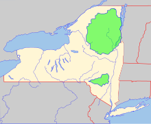
New York has many state parks and two major forest preserves. Adirondack Park, roughly the size of the state of Vermont and the largest state park in the United States, was established in 1892 and given state constitutional protection to remain "forever wild" in 1894. The thinking that led to the creation of the Park first appeared in George Perkins Marsh's Man and Nature, published in 1864. Marsh argued that deforestation could lead to desertification; referring to the clearing of once-lush lands surrounding the Mediterranean, he asserted "the operation of causes set in action by man has brought the face of the earth to a desolation almost as complete as that of the moon."
The Catskill Park was protected in legislation passed in 1885,[27] which declared that its land was to be conserved and never put up for sale or lease. Consisting of 700,000 acres (2,800 km2) of land,[27] the park is a habitat for bobcats, minks and fishers. There are some 400 black bears living in the region. The state operates numerous campgrounds and there are over 300 miles (480 km) of multi-use trails in the Park.
The Montauk Point State Park boasts the 1797 Montauk Lighthouse, commissioned under President George Washington, which is a major tourist attraction on the easternmost tip of Long Island. Hither Hills park offers camping and is a popular destination with surfcasting sport fishermen.
No comments:
Post a Comment